An Overview of Kin town
Access to Kin and Kin’s Climate
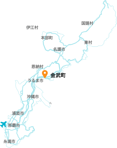
Kin is located roughly in the center of Okinawa Island and is bordered by Ginoza to the northeast, by Uruma to the southwest, by Onna across the Onnadake Mountain Range to the northwest, and by the Pacific Ocean to the southeast. From Naha it takes about 45 minutes by car on the Okinawa Expressway to the Kin Interchange. By normal roads it takes around 1 hour and 30 minutes. From Nago it takes about 20 minutes by car on the Okinawa Expressway and about 35 minutes on normal roads.
The climate is warm all year. Because the dense tree growth on the Onnadake Mountain Range blocks the winter winds, the average temperature is 22.6°C, the lowest monthly average temperature is 16.3°C in January, and the highest monthly average temperature is 28.7°C in July. The annual average precipitation is 1,919mm, so even in Okinawa’s subtropical climate the climate is particularly stable.
[By car]
From Naha
Okinawa Expressway about45 min (NahaIC > KinIC)
National highway, Prefectural road about 20 min (Naha > (route 58) > Onnna Nakadomari = > (route 73) > Ishikawa > (route 329) > Kin
The Abundant Nature of Kin
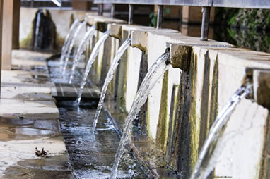
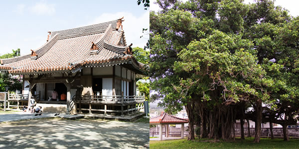
Occupying a plateau of Ryukyu limestone at the lush base of Mount Onna, Kin is an area that has long been famous for its bountiful underground water supply. With horizontal wells like Ukkaga and Kintaga, the area supported life as a precious source of useable water before the development of piped city water. Ukkaga was even selected as one of the “Top 100 New Okinawa Sightseeing Spots,” and this ever-flowing source of spring water is fondly known today as it was in the past as a “Fountain of Longevity.”
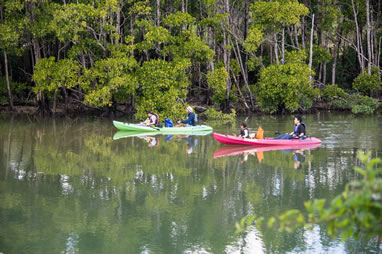
Additionally, Okukubigawa, with its prominent, thriving Mangrove forests, was selected as one of “Japan’s Top 100 Important Wetlands.” With a wide variety of wild birds inhabiting the area, it is also a famous area for birdwatching, and in addition to the sweeping view of the Mangrove forests visible from the viewing platform on the 280 meter long “Okukubigawa Promenade,” one can also view wildlife such as wild birds and crabs up close.
Kin’s Local Specialties

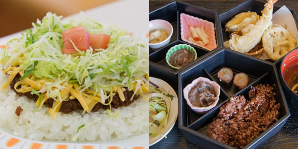
One item well-known throughout Japan as a local specialty of Kin is “Taco Rice.” Also deserving of the title of the Okinawan people’s soul food, Taco Rice was born in 1984 in Kin’s “Parlor Senri.” At an event carried out collaboratively by the Chamber of Commerce and Industry and eight neighborhood shops in 2010, the “World’s Largest Taco Rice” was officially recognized by the Guinness Book of World Records.
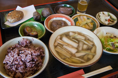
As for agricultural products, Kin is known as as a production center of taro, an indispensable ingredient of traditional Okinawan dishes. It is not only cultivated there, but also used to make taro pies, and a great deal of other processed foods. Additionally, flowers, fruit trees, vegetables, and sugar cane are cultivated and widely distributed as local specialty products.
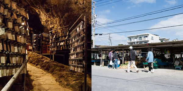
There are also two awamori breweries that make use of Kin’s abundant water supply and bring the deep flavor of traditional awamori into the modern day.
The History of Kin
Earthenware and other items excavated in the Okukubigawa area suggest that people first began living in Kin in the Jomon period. From there, in the Gusuku period that began around the 11th-12th century, the inland areas took center stage, and around the middle of the 17th century, the region that spans modern-day Kin and Ginoza was called Kin Magiri.
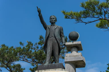
In the Meiji period, the han system was abolished, and “Kin Magiri” became known as “Kin Village.” In the Meiji and Taisho periods, it was also the first region to attempt international migration, represented by Toyama Kyuzo, known as the father of Okinawan immigration.
After the second world war, Camp Hansen was constructed in the village as a strategic center for the Korean War that broke out in 1950. In spite of the effects from the base, Kin Village continues to develop, and in 1980, after Okinawa was returned to Japan, “Kin Town” was born as a result of the switch to the town system.